North Iceland includes Akureyri, the Diamond Circle, Lake Myvatn, Godafoss, Dettifoss, Husavik, and Grimsey. Akureyri town had 20,067 people on 1 January 2026 and lies just south of the Arctic Circle.
Getting to know north Iceland and its capital Akureyri
Akureyri is Iceland's largest urban area outside the Greater Reykjavik area and is often called the capital of the north. Akureyri town had a population of 20,067 on 1 January 2026. Akureyri sits at the head of the Eyjafjordur fjord in north Iceland. Akureyri lies just south of the Arctic Circle. Akureyri has a domestic airport with regular flights from Reykjavik and sits on the Ring Road, also called Route 1.
Driving the Diamond Circle and getting between the main sights
The Diamond Circle is a driving loop in north Iceland. The Diamond Circle connects Godafoss waterfall, Lake Myvatn, Dettifoss waterfall, Asbyrgi canyon and the town of Husavik. The Diamond Circle can be driven in 1 day, but 2 days allow more time for viewpoints and walking paths. Godafoss lies along the Ring Road about 35 minutes by car from Akureyri. Lake Myvatn is about 84 kilometers from Akureyri, about a 1 hour 15 minute drive in normal conditions. Use the Driving Distance Calculator to help plan your trip.
Godafoss, Dettifoss and the waterfalls of the north
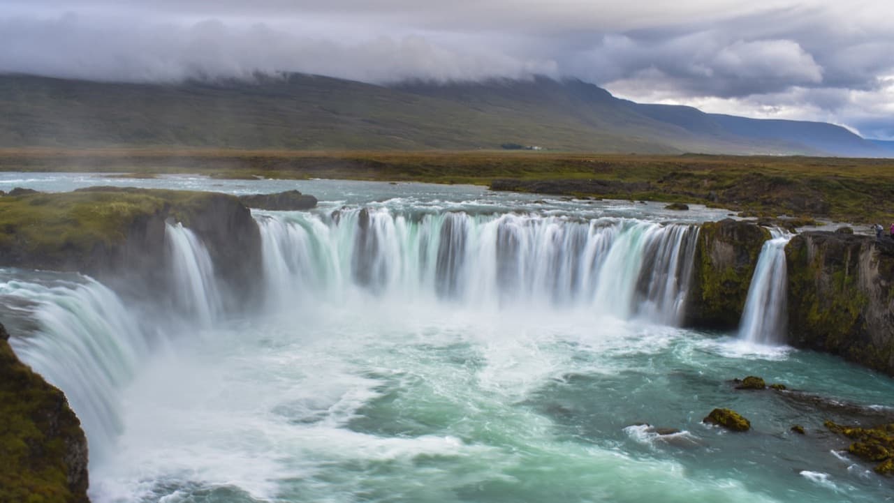
Godafoss means Waterfall of the Gods and is fed by the river Skjalfandafljot. Godafoss is about 12 meters high and about 30 meters wide, tumbling over horseshoe-shaped drops. A legend links Godafoss to the year 1000, when the lawspeaker Thorgeir is said to have thrown statues of the Norse gods into it after Iceland adopted Christianity. Dettifoss sits on the Jokulsa a Fjollum river, which flows from the Vatnajokull glacier. Dettifoss is about 100 meters wide and drops about 44 meters. Dettifoss has an average water flow of about 193 cubic meters per second and is one of the most powerful waterfalls in Europe. Dettifoss and Asbyrgi canyon lie within Vatnajokull National Park. Asbyrgi is a horseshoe-shaped canyon blanketed in vegetation and carved by rivers.
The Lake Myvatn region and its volcanic landscapes
Lake Myvatn covers about 37 square kilometers and was created by a lava eruption about 2300 years ago. Lake Myvatn has an average depth of about 2.5 meters and a maximum depth of about 4.5 meters. 15 species of duck breed at Lake Myvatn, the largest number in Europe. Hverfjall is an explosion crater near Myvatn that formed about 2500 years ago. Dimmuborgir is a field of dramatic lava pillars formed when lava drained from a temporary lava lake. Namafjall Hverir is a geothermal area near Myvatn with steaming vents and hot springs. The Krafla volcanic system near Myvatn erupted repeatedly between 1975 and 1984.
Whale watching and coastal wildlife across the north
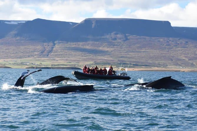
Husavik is known as the whale watching capital of Iceland and has among the highest sighting rates in the country. The whale watching season around Husavik runs from about April to October, with June and July often the best months. Husavik is known as the whale watching capital of Iceland and has among the highest sighting rates in the country. Grimsey is a small island about 40 kilometers off the north coast, and the Arctic Circle crosses Icelandic territory there. Grimsey covers about 5.3 square kilometers, has large seabird colonies including Atlantic puffins, and is reached by ferry from Dalvik or by flights to Akureyri. The Vatnsnes peninsula in the northwest is known for its seal colonies. Hvitserkur is a sea stack about 15 meters tall off the Vatnsnes peninsula, nicknamed the Troll of the North. The Trollaskagi peninsula has some of the tallest mountains outside the Icelandic highlands, and the town of Siglufjordur was the center of Iceland's early 20th century herring boom.
Comparing north Iceland tours and planning your visit
You can compare North Iceland tours to see the current options.