East Iceland is called Austurland. Egilsstadir is a long drive from Reykjavik by the Ring Road. There are regular flights from Reykjavik to Egilsstadir Airport, with a flight time of roughly 1 hour.
Where East Iceland is and how the region fits together
East Iceland is known in Icelandic as Austurland. The landscape of East Iceland is characterised by small villages, dramatic coastlines, narrow fjords, waterfalls and mountains. Egilsstadir is the largest town in East Iceland and the region's commercial and logistical hub. Egilsstadir sits inland on the banks of Lake Lagarfljot. Lagarfljot is one of Iceland's deepest lakes and its water covers about 140 km from its source in the Eyjabakkajokull glacier to Heradsfloi Bay. Icelandic folklore says Lagarfljot may be home to a monster known as Lagarfljotsormur, the Lagarfljot Worm.
The Eastfjords villages and towns worth your time
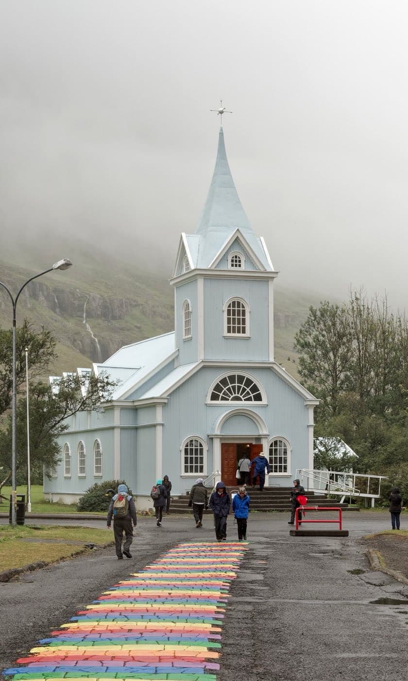
Seydisfjordur is famous for its Rainbow Street, a road painted in rainbow colours leading up to the town church. Seydisfjordur Church, called Seydisfjardarkirkja in Icelandic, is a bright blue church and one of the town's most photographed sights. Seydisfjordur is the arrival port for the Norrona ferry, operated by Smyril Line, which connects East Iceland with Denmark and the Faroe Islands.
Djupivogur is a small fishing village on Route 1, the Ring Road, and the village had a population of 407 on 1 January 2026. Djupivogur is about 85 km south of Egilsstadir by road. Djupivogur joined the Cittaslow movement in 2004 and is the only Icelandic town that is part of it. Eggin i Gledivik, the Eggs of Merry Bay in Djupivogur, is an artwork of 34 large stone eggs representing local bird species, created by artist Sigurdur Gudmundsson.
Petra's Stone Collection is in the village of Stodvarfjordur and was built up by Petra Sveinsdottir from stones and minerals collected across Iceland.
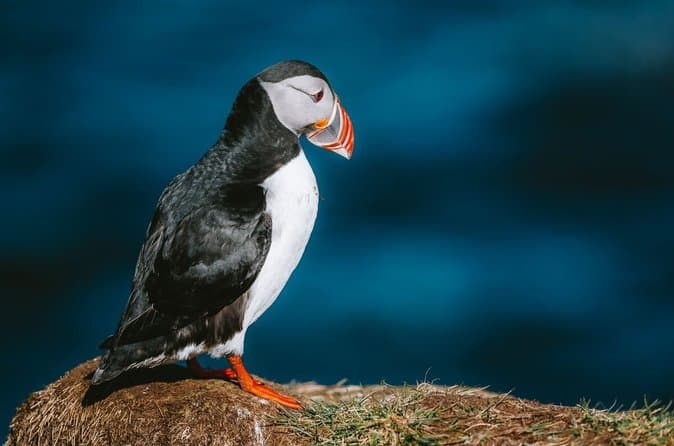
Hafnarholmi at Borgarfjordur eystri is a rocky islet with a puffin colony, connected to the mainland by a rock causeway.
Waterfalls, canyons and forests of the interior valleys
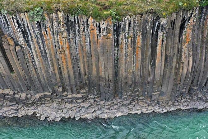
Hengifoss is about 128 m high and is ranked the third highest waterfall in Iceland. The cliff behind Hengifoss shows thick layers of basalt broken up by thin layers of red clay, creating a striped pattern. Litlanesfoss, also called Studlabergsfoss, sits below Hengifoss and is framed by tall hexagonal basalt columns.
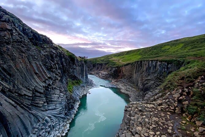
Studlagil canyon lies in the Jokuldalur valley and is known for its basalt columns and a glacial river that shifts from milky grey to bright turquoise. Studlagil's basalt walls were largely hidden until a hydro project lowered the river level and exposed them.
Hallormsstadur is the largest forest in Iceland, covering about 740 hectares. Hallormsstadur forest is about 25 km inland from Egilsstadir and has over 40 km of marked trails and footpaths. Hallormsstadur was preserved as Iceland's first national forest in 1905.
Wildlife and geothermal nature experiences in the east
Reindeer were brought to Iceland from Norway between 1771 and 1787. East Iceland is the only region of the country where wild reindeer still live.
Atlantic puffins arrive at Hafnarholmi in April and leave by early to mid-August, with the best viewing between May and July.
Vok Baths is a geothermal spa with floating pools on Lake Urridavatn, near Egilsstadir.
How to get to East Iceland and plan your route
Use the Driving Distance Calculator to help plan your trip.
Egilsstadir works as a base for day trips.
Comparing East Iceland tours and day trips
Departures in the east are far fewer than in the south, and most start from Seydisfjordur, such as an East Iceland nature and culture tour from Seydisfjordur. You can compare East Iceland tours to see the current options.