Kirkjufell Mountain is a 463-metre peak on the north coast of the Snæfellsnes peninsula, next to the town of Grundarfjörður and about 180 kilometres from Reykjavík. Its steep, symmetrical shape makes it one of Iceland's most-photographed mountains, and it stood in as the Arrowhead Mountain in Game of Thrones. This guide covers the drive, the neighbouring Kirkjufellsfoss waterfall, the geology, the filming history, and when to go.
Kirkjufell at a glance
| Kirkjufell | |
|---|---|
| Location | North coast of the Snæfellsnes peninsula, West Iceland |
| Nearest town | Grundarfjörður, about 2.5 km away |
| Height | About 463 metres |
| From Reykjavík | About 180 km, roughly two and a half hours |
| Screen fame | The Arrowhead Mountain in Game of Thrones |
| Beside it | Kirkjufellsfoss waterfall |
Getting there from Reykjavík
Kirkjufell sits about 180 kilometres northwest of Reykjavík, which is roughly a two-and-a-half-hour drive. You head north on Route 1, then turn onto Route 54, which runs out along the peninsula to Grundarfjörður, with the mountain about 2.5 kilometres past the town. The road is paved the whole way, though winter weather can slow the drive, so it is worth checking conditions before you set off. The car park by the waterfall is small and fills up in summer, and a parking fee applies, so arriving early or later in the day helps.
Kirkjufellsfoss and the classic view
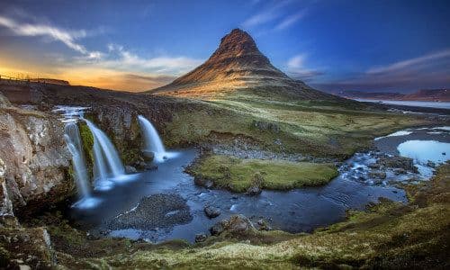
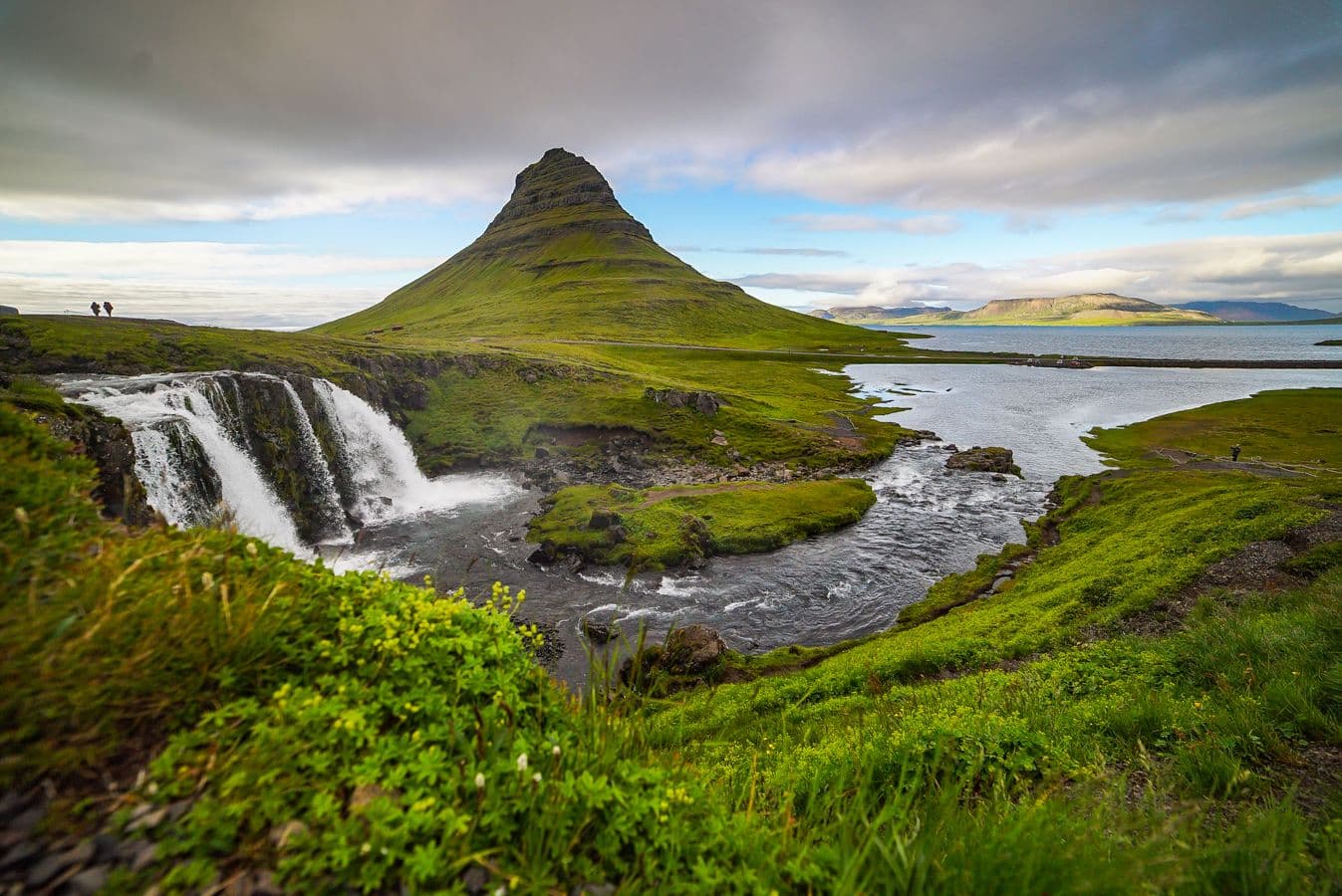
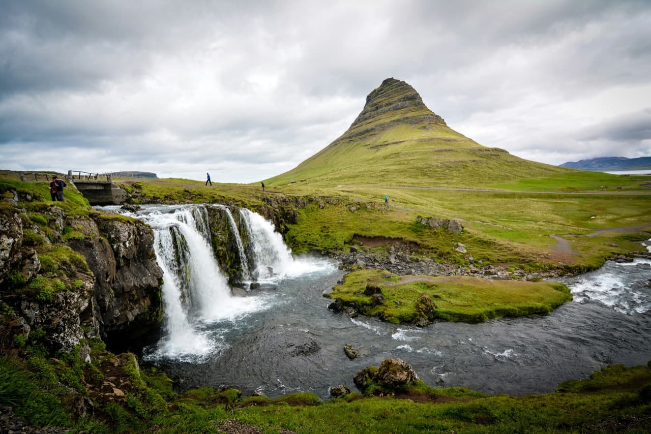
The photograph most people picture, the pointed peak rising behind a tumbling waterfall, is taken from beside Kirkjufellsfoss, a small waterfall directly across the road from the mountain. A short, well-worn path links the car park to the viewpoints, where the falls line up neatly in front of the peak. This is why the two names almost always appear together. The footing near the water can be wet and uneven, so sensible shoes help in any season.
The mountain and its name
Kirkjufell is built from layered volcanic and sedimentary rock and is often described as a nunatak, a peak that stood above the ice-age glaciers as they wore down the land around it. Despite that volcanic rock, the mountain is not itself a volcano. The name translates as "Church Mountain," after a profile that early residents likened to a church steeple. Reaching the summit involves a steep, exposed scramble that has caught people out, so most visitors take in the mountain from the base and the waterfall side rather than climbing it.
Game of Thrones: the Arrowhead Mountain
Kirkjufell appears in Game of Thrones as the Arrowhead Mountain in the lands north of the Wall, in seasons 6 and 7 of the series. It features in Bran Stark's vision of the far north, and again when a party travels beyond the Wall, and the distinctive shape is easy to recognise on screen. The connection brought a wave of visitors, and the mountain is now one of the most-recognised Icelandic locations from the show.
When to go
Kirkjufell is reachable year-round, and the season sets the scene. Summer brings long daylight and, around midsummer, the midnight sun low behind the peak, though it is also the busiest time for parking. Autumn adds colour to the surrounding slopes and thinner crowds. Winter can coat the mountain and waterfall in snow, and the dark, open setting makes it a well-known spot for the northern lights, which appear on clear nights roughly September to April.
Tours or self-drive
Kirkjufell suits a self-drive trip, since a car lets you fold it into a wider loop of the peninsula and stop at the coast and villages along the way. A guided tour is the simpler option if you would rather not drive the highway stretch, or if you only have one day. Day tours that name the mountain, such as a small-group Snaefellsnes and Kirkjufell day tour from Reykjavik, cover the peninsula in one long day. Operators set their own prices and the popular trips fill up in summer, so it is worth comparing current Snæfellsnes tours before you book.
Estimate the road time
Use the Driving Distance Calculator to work out how much driving time to allow around Kirkjufell.