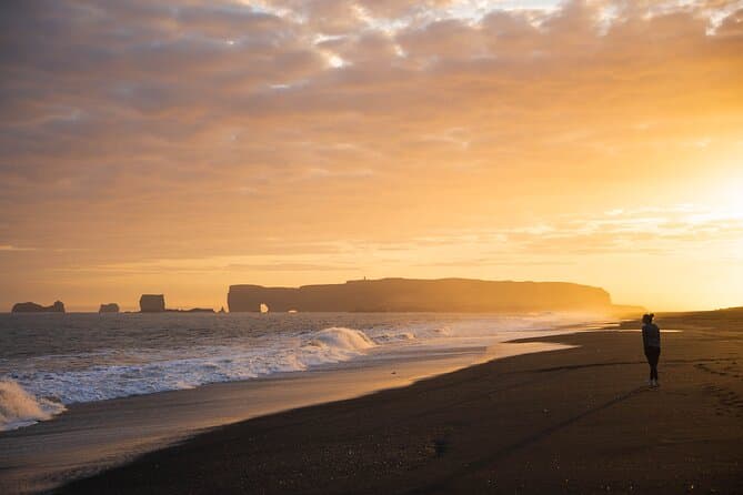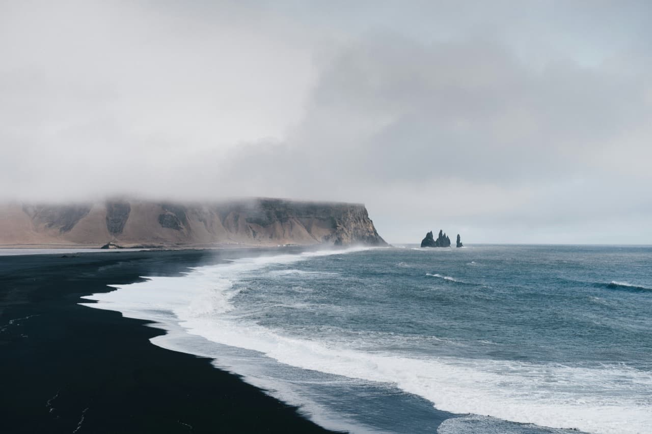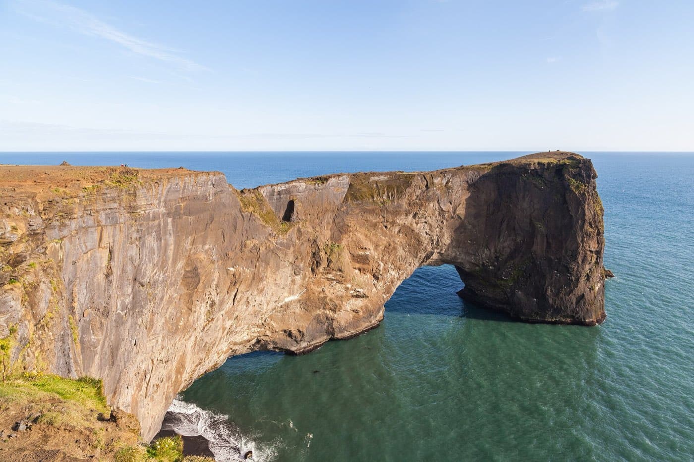
Dyrhólaey is a 120-metre promontory near the village of Vík on Iceland's South Coast, named for the large sea arch worn through the headland at its tip. It has been a nature reserve since 1978 and is one of the easier places to see puffins in summer, with wide views over the black sands of Reynisfjara. Parts of it can close for bird nesting between 1 May and 25 June, so timing matters.
Dyrhólaey at a glance
| Dyrhólaey | |
|---|---|
| What it is | Promontory and sea arch near Vík |
| Height | About 120 m above the sea |
| Protected | Nature reserve since 1978 |
| Puffins | Summer, roughly mid-May to August |
| Possible closures | 1 May to 25 June for nesting |
| Nearby | Reynisfjara black-sand beach |
The arch and the promontory
The name points to the sea arch worn through the headland, a gap large enough for boats to pass through when the water is calm. The promontory rises about 120 m above the sea, and a lighthouse stands on the clifftop looking out over the coast. To the east you can see the Reynisdrangar sea stacks, which rise from the water to 66 m, and the long black-sand shore that runs below them.
The lighthouse
Building the lighthouse on Dyrhólaey was pioneering work for lighthouses in Iceland. The first iron-frame lighthouse set up in Iceland was a Swedish one on Dyrhólaey. Guðjón Samúelsson, the state architect, did the original design of the present lighthouse. It was Iceland's first landfall light and also its brightest, and a radio beacon in the lighthouse once sent out signals that aircraft used to fix their position.
Puffins and other birdlife
Dyrhólaey is a working seabird colony. Atlantic puffins nest in burrows on the grassy clifftops in summer, roughly mid-May to August, along with eider ducks and other seabirds. It is one of the more accessible mainland spots to watch puffins, but the birds are raising chicks on a short schedule, so keep back from the cliff edges and away from the burrows, which collapse easily underfoot.
Seasonal closures for nesting
Because the site is both a reserve and an active colony, the Environment Agency can restrict access between 1 May and 25 June to protect nesting birds, with an ornithologist assessing the colony each year to decide what is needed. When limits apply, they have tended to focus on the higher ground around the lighthouse, often with daytime-only hours, while the lower area near the arch usually stays open. The exact dates, hours, and affected parts change from season to season, so check the current rules before you plan a visit rather than relying on a fixed schedule.
Views over Reynisfjara and getting there
Dyrhólaey sits just west of Reynisfjara and the village of Vík, so it fits naturally into a day along the South Coast. A short gravel road climbs to the upper car park and lighthouse when that area is open, while the lower parking sits closer to the arch. If you would rather not drive this stretch, you can compare guided South Coast tours that take in the coast around Vík; prices vary by operator and season, so check current options before booking.
Map the drive
Use the Driving Distance Calculator to see how Dyrhólaey fits with the other places on your route.