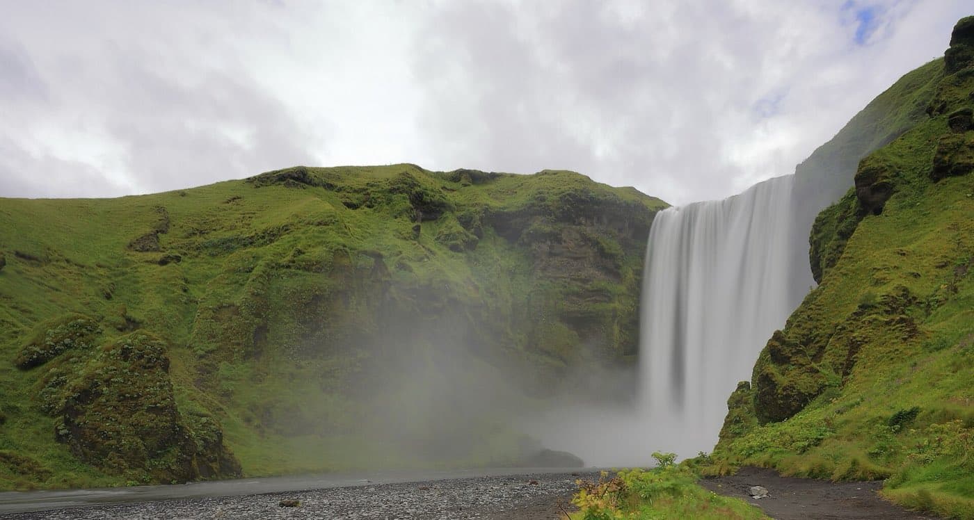
Skógafoss is a waterfall about 60 m (200 ft) high on the Skógá River, near the village of Skógar on Iceland's south coast. It sits about 155 km from Reykjavík, about a 2 hour 20 minute drive along the Ring Road. A staircase beside the falls climbs to a clifftop viewpoint, and the Fimmvörðuháls hiking trail to Þórsmörk starts at the same spot.
Skógafoss at a glance
| Feature | Detail |
|---|---|
| Location | Near Skógar, south Iceland |
| River | Skógá |
| Height | About 60 m (200 ft) |
| Width | About 25 m (82 ft) |
| Drive from Reykjavík | About 155 km, about 2 hr 20 min |
| Top access | Staircase on the east side to a clifftop platform |
| Onward hike | Fimmvörðuháls trail to Þórsmörk, about 25 km |
Getting to Skógafoss
Skógafoss lies just off the Ring Road near the village of Skógar in south Iceland. From Reykjavík the drive is about 155 km, about 2 hours 20 minutes on paved road. A car park sits at the base of the falls, a short walk from the water, so the front-on view needs no climbing.
The waterfall up close
The falls drop about 60 m (200 ft) over a cliff that marks Iceland's former coastline, and the sheet of water is roughly 25 m (82 ft) wide. Because the Skógá River carries a steady flow, the base throws up constant spray, and rainbows often appear on sunny days. You can walk right up to the foot of the falls on flat ground, though you will get wet if the wind pushes the spray toward you.
Climbing to the top
A metal staircase runs up the slope on the east side of the falls to a viewing platform at the clifftop. The climb is steep, and the step count is reported differently by different sources, so allow time to pause on the way up. From the platform you look straight down the drop and out over the flat coastal land.
The Fimmvörðuháls trailhead
The same clifftop path is the start of the Fimmvörðuháls trail, which climbs to the pass between the glaciers Eyjafjallajökull and Mýrdalsjökull and then descends to Þórsmörk on the far side. The route runs about 25 km and is a long full-day walk, often split over two days with a night at the mountain huts. Beyond Þórsmörk the path continues as the Laugavegur trail toward Landmannalaugar. This is high, exposed ground that holds snow well into summer, so it calls for proper gear and settled weather.
Visiting tips
Bring waterproofs, because the spray reaches the viewing area at the base and the staircase can turn slick. Sturdy shoes help on the metal steps and the upper path. Skógafoss is a common stop on south coast day tours from Reykjavík, so if you would rather not drive, you can compare south coast tour options and see what each itinerary covers. Early morning and late evening tend to be quieter than the middle of the day.
Map the drive
Use the Driving Distance Calculator to see how Skógafoss waterfall fits with the other places on your route.